LA to Big Sur – The Road Trip That Actually Feels Like Freedom
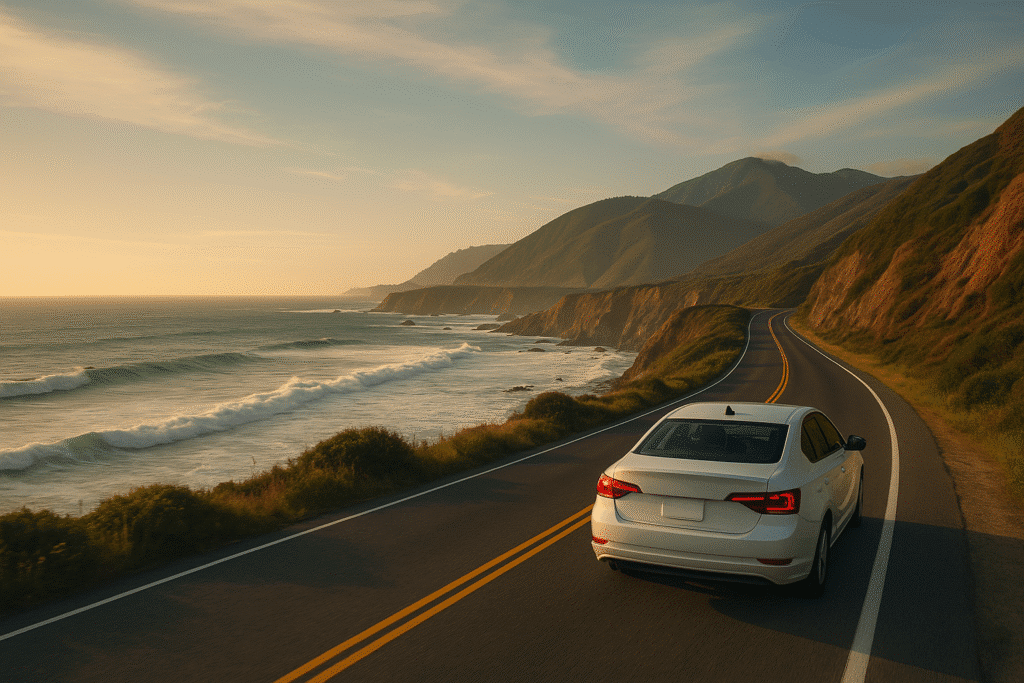
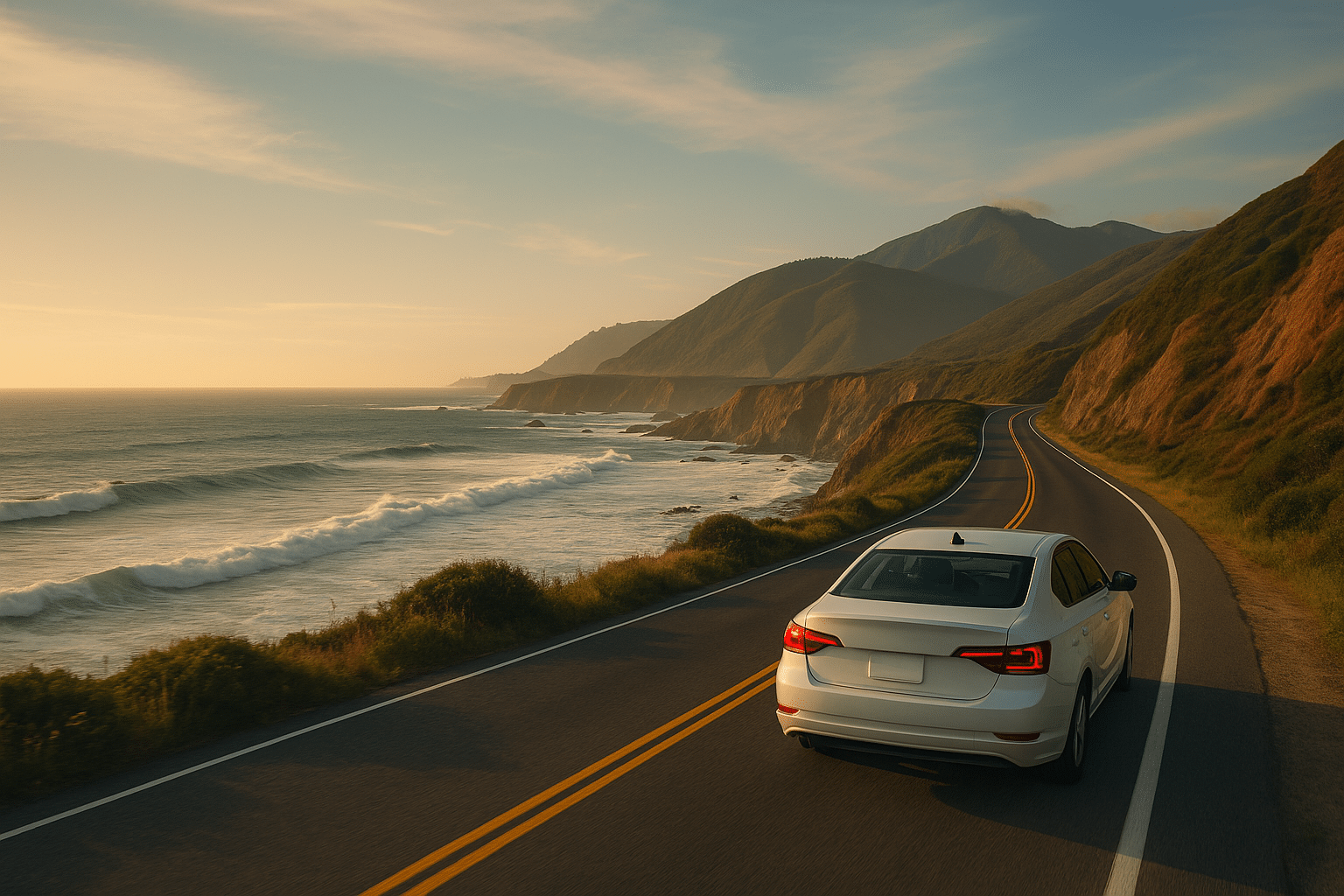
There’s something about packing up your car, cranking the music, and hitting the Pacific Coast Highway that just feels… right. LA to Big Sur isn’t just a drive; it’s a mood. You’re basically trading smoggy freeways for jaw-dropping cliffs and waves that smash the coastline like they’ve got a grudge. And honestly? It’s the kind of road trip that doesn’t need a perfect plan—you just need a tank of gas, some snacks, and maybe someone who won’t complain about your playlist.
I’ve done this trip more than once, and every single time, I catch myself pulling over at random spots just to stare at the view (or to stress-eat beef jerky because of those hairpin turns on Highway 1). If you’re looking for that “I’m free” road trip vibe, this is it. It’s less about the destination (although Big Sur is breathtaking) and more about the way you get there.
Why Drive from LA to Big Sur Instead of Just Flying Somewhere Else?
You might be thinking—“Why not just fly to San Francisco or Monterey and save the hassle?” Yeah, you could. But you’d miss half the fun. The drive from LA to Big Sur is iconic for a reason. It’s not like other road trips where you’re counting the minutes until you’re there. The second you hit that stretch of Highway 1, it’s all ocean views, cliffs, and those random hidden beaches that make you want to pull over every five minutes.
The drive itself feels like an adventure. You roll through Santa Barbara, cruise past Pismo Beach, and somewhere along the way, you realize you’re slowing down—not because of traffic, but because you actually want to take it all in. It’s the kind of trip where you catch yourself saying, “Okay, one more stop,” and three hours later, you’re still not at Big Sur. And that’s the point.
The Whole Vibe of the Pacific Coast Highway
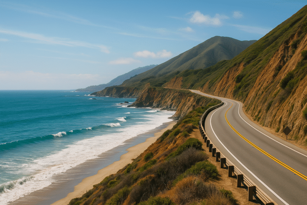
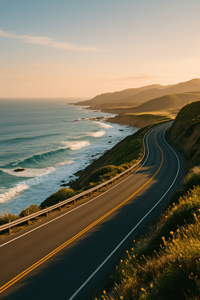
If you’ve never driven the PCH (Pacific Coast Highway), prepare for your jaw to hurt from being permanently dropped. The road hugs the coastline like it’s scared to let go, and on one side you’ve got endless ocean, and on the other, cliffs and forests that make you feel like you’re in a movie. It’s dramatic. It’s moody. And it’s one of those drives where the journey is literally better than the destination.
What Makes This Drive So Freakin’ Famous?
Part of it is the views, obviously. But it’s also the vibe. Highway 1 is like a time capsule—no massive billboards, no endless chain restaurants, just nature doing its thing. It’s one of the few places where you can actually disconnect (partly because cell service sucks, but also because you kinda want to).
How Far is LA to Big Sur (And How Long Are You Stuck in the Car)?
Alright, let’s talk logistics because as dreamy as this sounds, it’s still a long drive. From LA to Big Sur, you’re looking at about 300 miles, give or take, depending on where in LA you start. That’s about 5 to 6 hours of driving—if you don’t stop every 20 minutes for photos (which you probably will).
If you just want to get there fast, you could take the 101 and cut out some time. But then you’re missing Highway 1. And honestly? If you’re not taking the scenic route, what’s even the point?
LA to Big Sur Drive Time and Distance
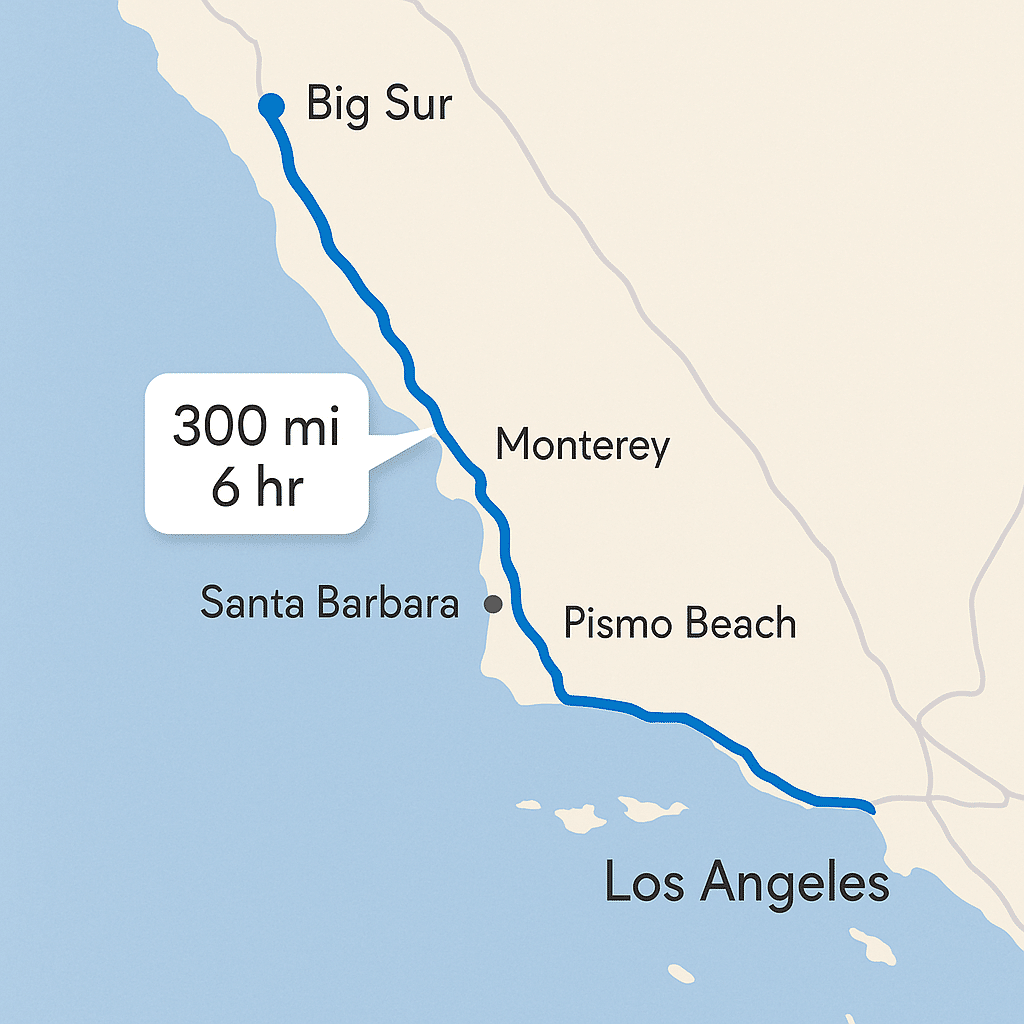
Distance: Roughly 300 miles.
Drive Time: 5–7 hours depending on stops and traffic.
Best Route: I-10 W → 101 N → Highway 1 (Pacific Coast Highway).
The Highway 1 Route – Totally Worth the Extra Time
Taking Highway 1 might add an hour or two to your trip, but you’ll thank yourself. You get those iconic Big Sur curves, and every single viewpoint feels like it was made for Instagram. Plus, there are tons of little coastal towns you can hit up for coffee or tacos.
Alternatives: Can You Take a Train from LA to Big Sur?
Technically, you can take a train to San Luis Obispo or Salinas and then drive the rest, but it’s not a straight LA to Big Sur train. So unless you really hate driving, just hop in the car. Trust me—this is one of those drives you’ll actually enjoy.
When’s the Best Time to Do a LA to Big Sur Road Trip?
You could do it any time of year, but the seasons hit different along the California coast. Summer is popular (aka crowded), spring brings wildflowers, and fall might just be the sweet spot—warm days, fewer tourists, and that golden California light that makes everything look cinematic.
Seasons, Fog, and That Random Coastal Chill
Here’s the thing: Big Sur has its own weather drama. Even in summer, you’ll get this mysterious morning fog (locals call it “June Gloom”) that makes everything feel a little moody. Bring a hoodie or a jacket—yes, even if it’s 90 degrees in LA when you leave.
The Sweet Spot Months to Avoid Traffic and Crowds
April–May or September–October are golden. The roads are less packed, the weather’s solid, and you’re not elbowing other tourists to get a shot of Bixby Bridge.
The LA to Big Sur Road Trip Itinerary That Won’t Bore You
Now let’s get to the good stuff—the actual stops and routes that make this trip worth it. Whether you’re doing it in one epic day or stretching it over a few, you’re gonna want a plan (or at least a loose one).
Best Spots in Big Sur: Hidden Gems & Must-See Attractions From a First-Hand Perspective
The “Just One Day” Plan
If you’re short on time, you can do LA to Big Sur and back in one long day, but prepare for a LOT of driving. Start early (like 5 AM early), make a quick stop in Santa Barbara for coffee, and then aim for McWay Falls or Pfeiffer Beach as your main Big Sur stop. On the way back, hit a sunset spot like Morro Bay.
The “Screw It, I’m Taking 3 Days” Itinerary
This is the way to do it. Day one, chill in Santa Barbara or Pismo Beach. Day two, cruise the PCH and hit all the Big Sur spots—Bixby Bridge, McWay Falls, Pfeiffer Beach. Day three, head back slow, maybe stop in Solvang for pastries (trust me).
The Best Stops Between LA and Big Sur
Santa Barbara (brunch and beach stroll)
Pismo Beach (clams and ocean views)
Morro Bay (that massive rock)
Elephant Seal Vista Point
Ragged Point (breathtaking viewpoints)
Must-See Spots on the Big Sur Drive
You can’t just blast through Big Sur like it’s a freeway. The whole point is to slow down and hit all the spots that make you go, “Whoa, did I just step into a movie scene?” These are the must-sees—the places where you’ll want to pull over, snap a thousand photos, and probably sit there for 20 minutes doing nothing but staring at waves.
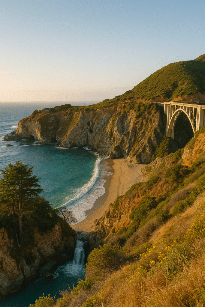
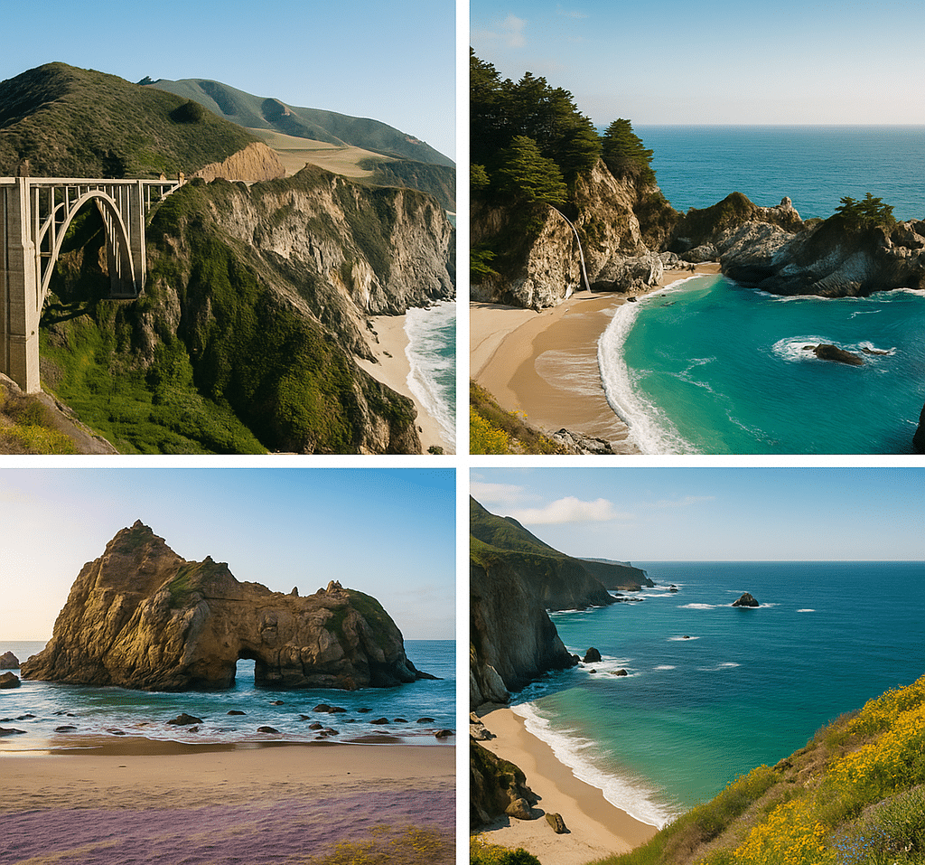
Bixby Bridge – Yes, It’s That Iconic
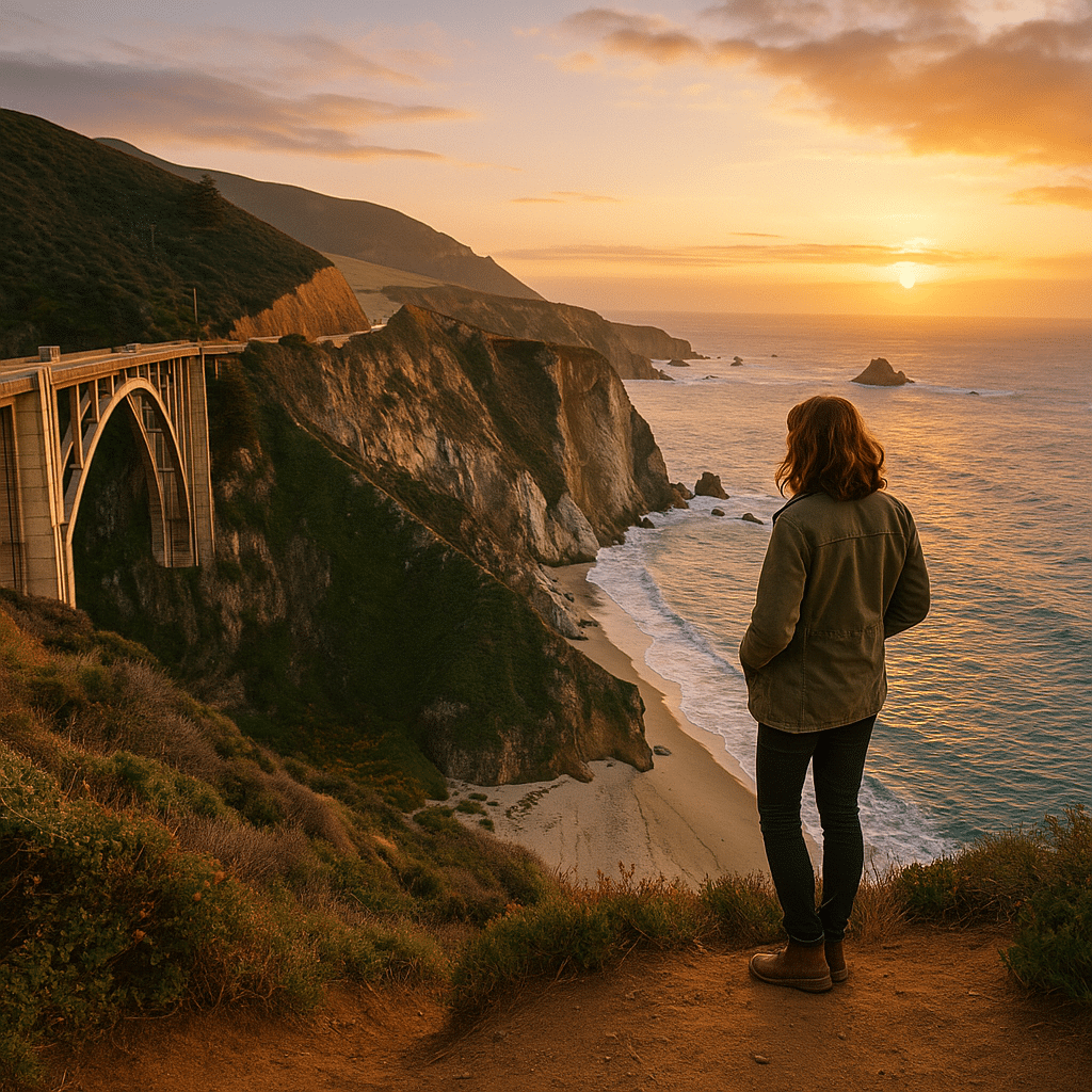
Bixby Creek Bridge isn’t just another bridge. It’s the bridge. You’ve seen it in car commercials, Instagram posts, maybe even wallpaper on your laptop—and trust me, it looks even better in real life. It’s this tall, sleek concrete arch that somehow looks delicate and dramatic at the same time, stretching across a canyon with the ocean roaring below. Sunset? Forget about it. The way the light hits the cliffs makes everything look golden.
One tip: don’t just pull over at the main lookout with the crowd of tourists and selfie sticks. Drive a bit further north and you’ll find smaller pull-offs with better angles and fewer people. Also, if you’re scared of heights… just don’t look down.
McWay Falls – The Waterfall You’ve Seen on Instagram
This is probably the most famous spot in Big Sur—and for good reason. McWay Falls is an 80-foot waterfall that drops straight onto the sand (well, almost; sometimes the tide covers the beach). It’s like something you’d expect to see in Hawaii, not California. The best part? You don’t even have to hike for hours to see it. It’s literally a short stroll from the parking lot.
Pro tip: The official viewing platform is currently under some renovations, but the roadside pull-off as you approach the park gives you a killer view. Just be careful—cars zip around that corner like it’s a racetrack.
Pfeiffer Beach – Purple Sand? Yep, It’s Real.
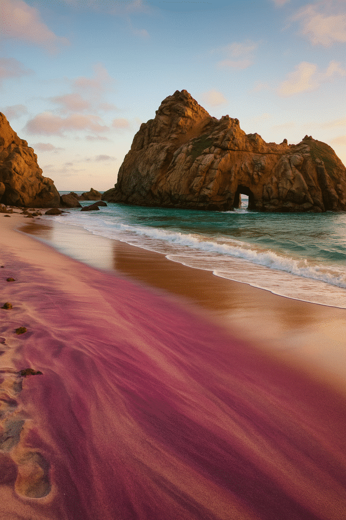
You ever seen purple sand? No, it’s not Photoshopped—it’s real at Pfeiffer Beach. The sand gets its color from manganese garnet in the surrounding rocks, and when the light hits it just right, the beach looks like something out of a fantasy movie. Oh, and there’s Keyhole Arch—a natural rock arch that photographers lose their minds over, especially in winter when the sunset light blasts right through the hole like nature’s own spotlight.
But here’s the catch: the road to Pfeiffer Beach is easy to miss, and it’s narrow and winding. Keep your eyes peeled for Sycamore Canyon Road off Highway 1, or you’ll drive past it without even realizing.
Garrapata State Park – Wildflowers, Cliffs, and Ocean Spray
This spot doesn’t get as much hype as Bixby or McWay Falls, but honestly? It’s just as epic. In spring, the whole place explodes with wildflowers—like yellow, purple, and red blooms all over the cliffs. There’s a short bluff trail that’s only about a mile long, but every single step feels like a postcard view.
Oh, and Calla Lily Valley is here too. Yeah, it’s as gorgeous as it sounds. If you time your trip right (usually mid-February to March), the valley fills up with these pristine white lilies, and it’s just… wow. Just don’t trample the flowers or try to get “the perfect Instagram shot.” Be cool.
Where to Eat Between LA and Big Sur (Because Snacks Are Life)
Let’s be real—you can’t survive a 5–7 hour road trip on gas station chips alone. Between LA and Big Sur, there are some legit food stops that make the drive even better. Think tacos, coffee that doesn’t taste like dirt, and diners that look like they haven’t changed since the ‘70s (in a good way).
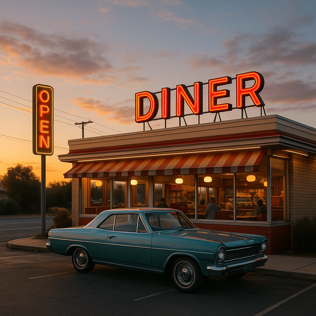
Roadside Diners That Are Way Better Than They Look
There’s something magical about a greasy spoon diner halfway through a road trip. The kind where the menu has everything from pancakes to burgers and the coffee refills are bottomless. One of my favorites? Madonna Inn Copper Café in San Luis Obispo. It’s kitschy, it’s pink (like really pink), and the cakes are amazing. Even if you’re not hungry, just stop and look around—it’s a vibe.
Another must-hit: Splash Café in Pismo Beach. Their clam chowder in a bread bowl? Unreal. Grab one to go and thank me later.
Local Spots in Carmel or Monterey
Once you’re near Big Sur, food options get pretty limited (and pricey), so stock up before you hit the remote stretch. If you swing through Carmel, La Bicyclette is this cozy French-style café with wood-fired pizzas that will ruin all other pizzas for you. Or, if you’re more of a fish taco person, The Big Sur Taphouse is a great stop—beer, tacos, and a patio that feels like the ultimate road trip pitstop.
Where to Crash – Hotels, Cabins, or Van Life?
Now, if you’re doing this road trip right, you’re not just driving up and back in one day. You’re staying somewhere. And Big Sur is loaded with cool places to crash—whether you want a cozy cabin, a bougie lodge, or you’re just sleeping in the back of your car like a rebel.
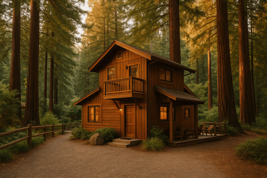
Big Sur Lodges That Don’t Feel Like Chain Hotels
If you want that rustic-but-classy vibe, Big Sur River Inn or Glen Oaks Big Sur is where it’s at. Think fireplaces, warm wood interiors, and a kind of “I’m one with nature but still have Wi-Fi” vibe. It’s not cheap, but nothing in Big Sur really is.
Camping Options and Free Spots
Big Sur has some great campgrounds like Pfeiffer Big Sur Campground and Ventana Campground. But heads up—they book up months in advance. If you’re more of a “wing it” person, there are a few free camping spots if you know where to look (hint: check apps like iOverlander). Just make sure you’re not trespassing—locals aren’t fans of random vans parking wherever.
The Ultimate Guide to the Antique Car Museum of Iowa in Coralville, IA
What to Pack for the Drive from LA to Big Sur
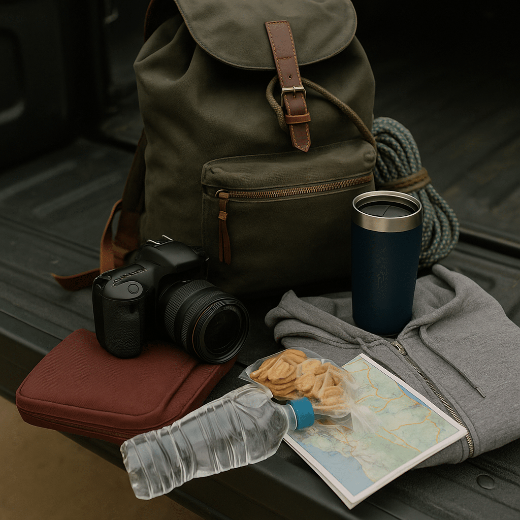
This isn’t a complicated road trip, but you don’t want to get stuck without the basics. It’s not like there’s a Starbucks every 5 miles once you’re deep in Big Sur. Here’s what I always throw in my car:
The “Don’t Forget This” Road Trip Gear
Water & snacks: (Obviously.)
Layers: Big Sur can go from sunny to “why is it suddenly freezing?” in 10 minutes.
Camera: Your phone is fine, but you’ll regret not bringing a real camera for these views.
Offline maps: Cell service is basically a rumor on Highway 1.
Emergency kit: Spare tire, jumper cables, all that boring but necessary stuff.
Reusable coffee mug: Because stopping for gas station coffee is a crime against good road trips.
Clothes You’ll Actually Wear on the Coast
Keep it simple—comfortable jeans, sneakers, maybe a windbreaker. If you’re stopping for photos (you will), something that doesn’t scream “road trip zombie” is a good idea. And yes, bring a hoodie or jacket, even in summer. Trust me.
Driving Tips for Highway 1
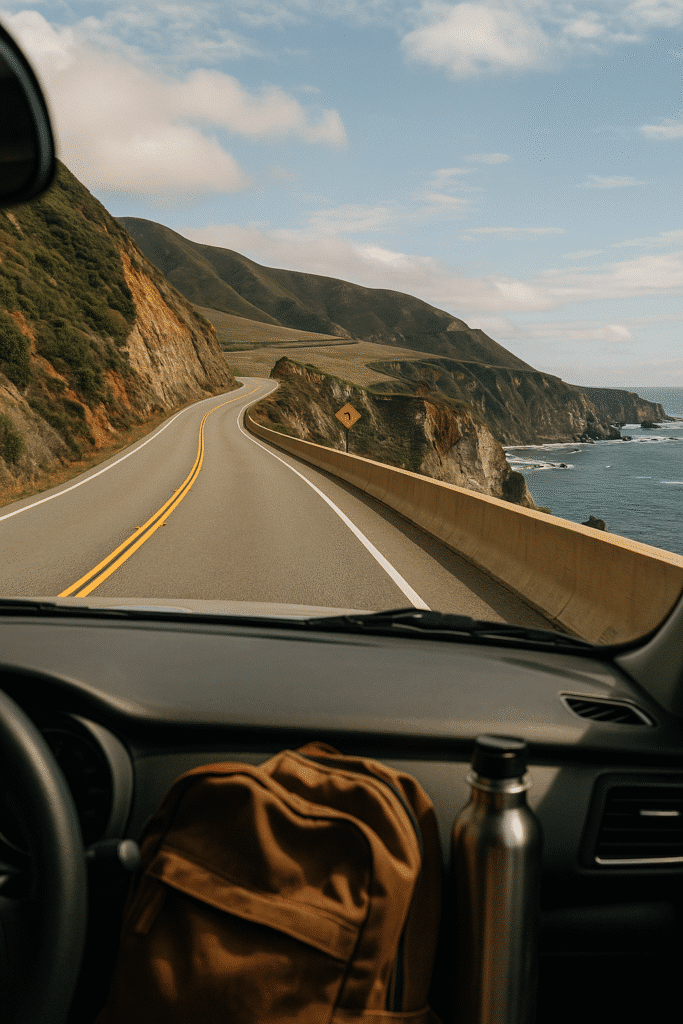
Let’s be real—Highway 1 is both dreamy and slightly terrifying if you’re not used to winding cliffside roads. The views are breathtaking, but so are the turns. This isn’t one of those “throw on cruise control and chill” drives. You need to stay awake and actually, you know, pay attention.
Avoiding Traffic, Bad Gas Stations, and Tourist Jams
Leave early. If you start your LA to Big Sur road trip around 9 AM, good luck—traffic in LA alone will eat an hour of your life. Hit the road by 6 or 7 AM, grab coffee to go, and you’ll avoid the worst of it.
Gas up before the coast. There are only a handful of gas stations along Highway 1, and they know you’re desperate. That’s why gas prices in Big Sur are basically highway robbery (pun intended). Fill up in LA or Santa Barbara to save yourself $8-a-gallon regrets.
Tourist choke points. Bixby Bridge, McWay Falls, and Pfeiffer Beach are all notorious for parking drama. If you want to enjoy them without losing your mind, hit these spots early in the day or later in the evening.
Safety Tips for Those Tight Coastal Curves
Highway 1 is gorgeous but also has some hairpin turns that’ll make your stomach drop if you’re not careful. A few tips:
Slow down. Seriously, you don’t need to take those curves at 50 mph.
Use turnouts. If you’re taking it slow and see a line of cars behind you, pull over at a turnout and let them pass. (People will love you for this.)
Watch for wildlife. Deer and raccoons don’t care about your Instagram schedule. Stay alert, especially at dusk.
No service = no distractions. Put your phone on airplane mode and just enjoy the drive. No texts, no maps constantly recalculating—it’s kinda nice, actually.
Things No One Tells You About Big Sur
Everyone raves about Big Sur’s beauty (which, fair), but there are a few things you won’t find in the glossy travel guides. You need to know these before you roll in expecting it to be all easy-breezy.
Spotty Cell Service and Random Closures
Big Sur doesn’t care about your 5G plan. Once you’re on Highway 1, you’ll lose service fast, so don’t rely on Google Maps to bail you out. Download offline maps or, you know, go old-school and bring a paper map (yeah, those still exist).
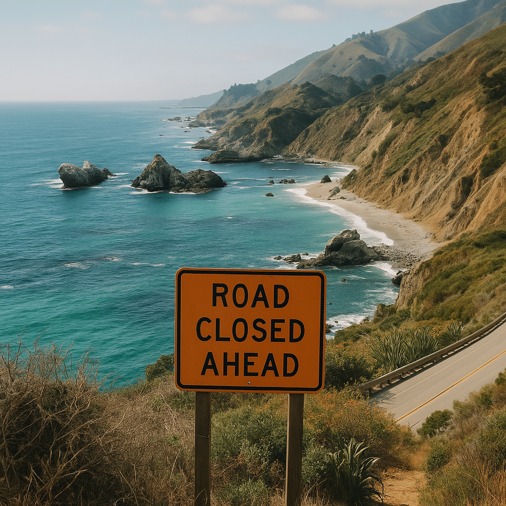
Also, landslides happen here—a lot. Highway 1 gets closed more often than you’d think, especially in winter or after heavy rain. Always check Caltrans or local road updates before you leave. There’s nothing worse than driving three hours only to hit a “ROAD CLOSED” sign with no warning.
Leave No Trace (Seriously, People Are Watching)
Big Sur is one of those places where people get real cranky about tourists trashing the environment—and honestly, they should. Don’t climb fences for a “cool photo,” don’t pick flowers, and don’t leave your trash anywhere. The locals are protective of this place, and if you respect it, you’ll have a much better time.
Final Thoughts – Is the LA to Big Sur Drive Worth It?
Short answer? Hell yes. It’s not just a road trip—it’s an experience. There’s something about going from the chaos of LA to the quiet, rugged coastline of Big Sur that just hits different. It feels like pressing a reset button on your brain. And the best part? Every single time you drive it, you’ll find something new—some little pull-off you didn’t notice last time or a random beach that looks like it’s straight out of a movie.
Would I do it again? Absolutely. Would I tell you to do it even if you only have one day? Yep. Just pack snacks, load up your playlist, and go. You won’t regret it.
Frequently Asked Questions
It’s about 300 miles, which usually takes 5–6 hours depending on traffic and stops. But let’s be honest—you’re going to stop a lot, so budget more time.
Big Sur is roughly halfway between the two, but it’s slightly closer to San Francisco. That said, the LA to Big Sur route is longer—and way more scenic.
Yes, and you should. It’s slower than the 101, but the views are legendary. Highway 1 is the road trip.
Spring (April–May) or early fall (September–October) is perfect. Fewer crowds, good weather, and amazing views.
Not directly. You can take Amtrak to San Luis Obispo or Salinas, then rent a car. But honestly, driving the whole way is way better.