Why Big Sur Feels Like a Dream Drive
What’s So Special About Big Sur Anyway?
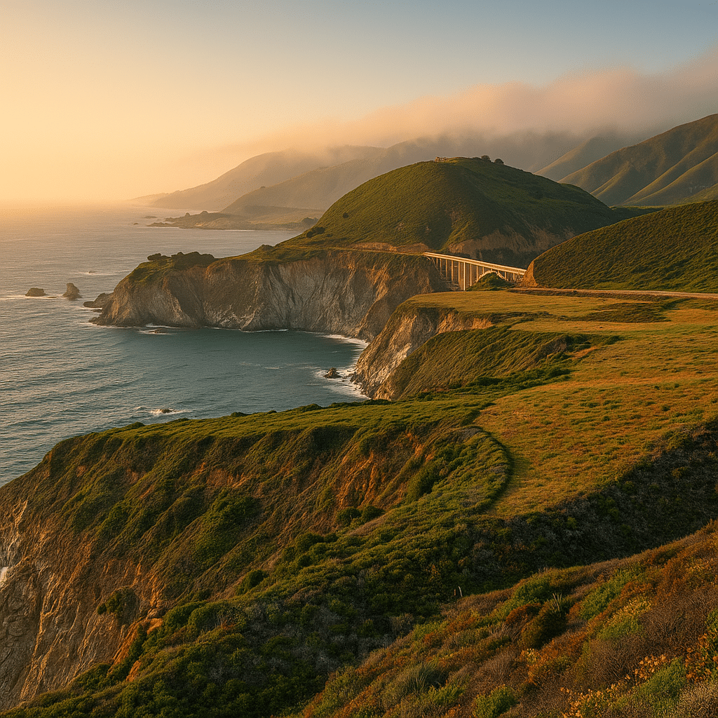
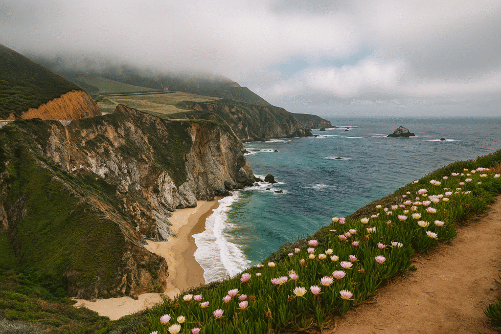
Okay, let me just say this—Big Sur is not overrated. I had the same thought you probably have right now: “Is this just another overhyped California thing?” Nope. This place is raw, rugged, and honestly, a little untamed. It’s a 90-mile stretch of coastline along Highway 1 that feels like nature just went all out—towering cliffs, fog that rolls in like it’s on a movie set, and beaches that look like they belong in some secret magazine spread.
You know how some places look amazing on Instagram but then feel meh in real life? Big Sur is the opposite. It’s so good, photos can’t do it justice. I remember pulling over somewhere between Garrapata State Park and Bixby Creek Bridge and just standing there, like a total idiot, because I couldn’t process how stunning it was.
And here’s the kicker: there’s no single “town” called Big Sur. It’s more like this random, magical stretch of road with hidden turn-offs, state parks, and beaches. You don’t just drive Big Sur—you experience it, one jaw-dropping stop at a time.
Highway 1 – The Kind of Road That Hooks You
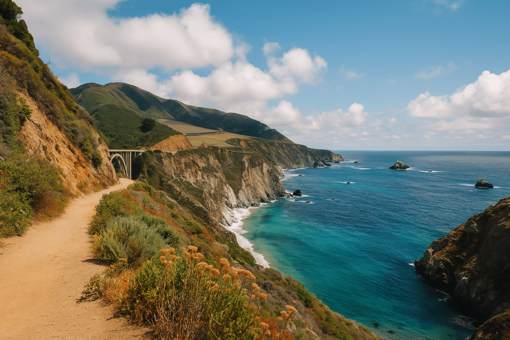
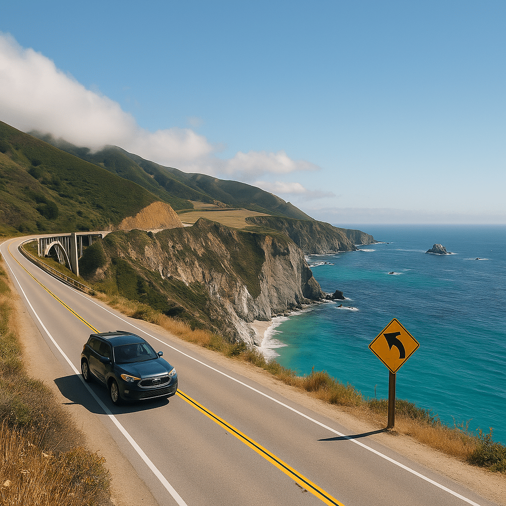
If you’ve ever heard people talk about California Highway 1, you know it’s one of the most scenic drives in the U.S. (maybe even the world). The Big Sur portion is where Highway 1 goes full Hollywood—winding turns, dramatic drop-offs, and ocean views that make you want to roll down the windows, crank up the music, and just vibe.
Is it dangerous? Meh, not really. The road’s narrow, and yes, there are cliffs, but as long as you’re not texting or trying to snap photos while driving, you’re fine. Plus, you’ll want to go slow because every curve reveals something new. One second it’s turquoise waves crashing against jagged rocks, the next it’s a redwood forest that looks straight out of a fairytale.
How to Get to Big Sur (Without Losing Your Mind)
Closest Airports and Rental Cars
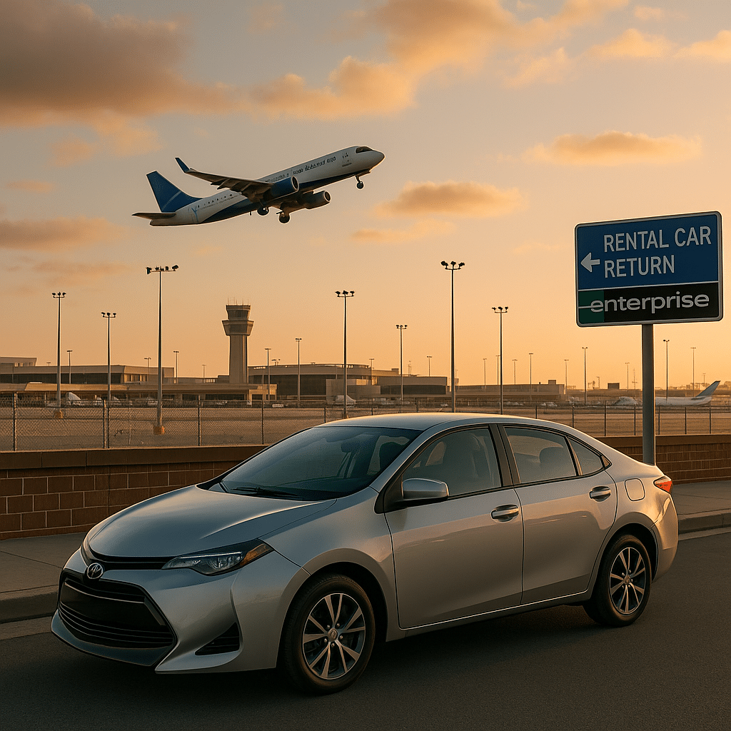
First things first—you can’t “fly” to Big Sur. The closest airports are San Francisco (SFO), San Jose (SJC), or Monterey (MRY) if you’re lucky enough to snag a good flight deal there. If you’re coming from further away, flying into SFO is usually the best bet, then renting a car. And you’re gonna need a car. This isn’t a place for Ubers or public buses—it’s all about you, your car, and the open road.
If you can, get a convertible or something with a sunroof. I mean, imagine cruising along Highway 1 with the salty air whipping through your hair. It’s the stuff road trip dreams are made of.
From San Francisco vs. From Los Angeles – Which Route Wins?
Here’s the age-old debate: start in San Francisco and head south or start in Los Angeles and go north? Personally, I vote north to south every time. Why? Because you’ll be on the right side of the road (closest to the ocean), which means all those epic pull-offs are just a quick turn away.
From San Francisco: It’s about 2 hours to Carmel-by-the-Sea, the unofficial start of Big Sur.
From Los Angeles: You’re looking at around 4–5 hours just to get to San Simeon, the southern end of Big Sur (and that’s without LA traffic, which is basically a gamble).
If you’ve got the time, do the whole thing—SF to LA via Big Sur. It’s a road trip you’ll remember forever.
Explore the Best Routs on Google Maps
Best Time to Plan Your Big Sur Road Trip
When the Weather and Crowds Actually Cooperate
Big Sur doesn’t really do “bad weather,” but it does have its quirks. Summer brings the crowds (and I mean, crowds—parking at Bixby Bridge can feel like a theme park), while winter brings rain and the occasional mudslide that shuts down parts of Highway 1.
Spring (March–May) is magic—wildflowers explode everywhere, the weather’s mild, and it’s not quite peak tourist season. Fall (September–October) is equally dreamy, with warm days and fewer people. Summer’s great too, if you don’t mind sharing every viewpoint with a dozen other travelers.
Fog, Rain, and That Moody Coastline
Let’s talk about the fog (locals call it “June Gloom” for a reason). There are mornings when you can’t see two feet in front of you, but don’t freak out—it usually burns off by midday, and when it does? The views are unreal.
Rain, on the other hand, can mess with your plans. Highway 1 is prone to rockslides after heavy storms, so always check the road conditions before you go. Nothing kills the Big Sur vibe faster than realizing the road is closed halfway through your trip.
How Long Do You Really Need for Big Sur?
Day Trip vs. Multi-Day Adventure
Here’s the truth: you can do Big Sur in a day, but you’ll feel rushed. It’s like speed-dating with Mother Nature—you’ll see the highlights, but you won’t get to know the place. If all you’ve got is one day, hit the heavy hitters: Point Lobos, Bixby Bridge, Pfeiffer Beach, and McWay Falls.
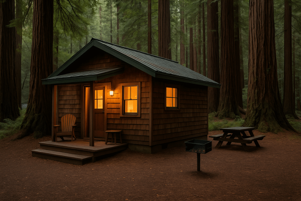
But if you can stretch it to 2–3 days, do it. Spend a night in a cabin or even better, camp under the redwoods. Drive slow, take detours, eat at random roadside cafes, and actually breathe in the views. Trust me, you won’t regret it.
Sample Big Sur Road Trip Itineraries (1, 2, and 3 Days)
1 Day: Start in Carmel → Point Lobos → Garrapata → Bixby Bridge → Pfeiffer Beach → McWay Falls → Head back.
2 Days: Add Limekiln State Park, Sand Dollar Beach, and a night camping or glamping.
3 Days: Go all the way down to San Simeon, see Hearst Castle, then loop back with plenty of time for hikes and random stops.
San Francisco to Big Sur Distance: Your Complete Coastal Road Trip Guide
Tips You’ll Wish Someone Told You Before Driving Big Sur
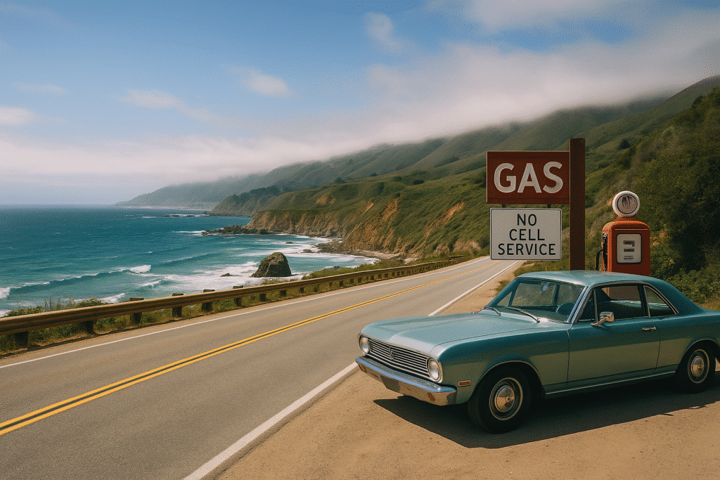
Gas Stations, Snacks, and Zero Cell Service
Let’s just say Big Sur isn’t exactly overflowing with conveniences. Gas stations? Rare, and when you do find one, the prices are brutal. Fill up before you hit Carmel or San Simeon.
Food? There are a few iconic spots like Nepenthe and Big Sur Taphouse, but I always pack snacks—trail mix, fruit, and yeah, a bag of sour gummy worms because road trips without candy just feel wrong.
And your phone? Forget about it. There’s basically no signal for most of the drive. Download maps ahead of time (or just wing it—there’s literally one road, you won’t get lost).
Tips You’ll Wish Someone Told You Before Driving Big Sur (Continued)
Driving Highway 1 – Is It Scary?
Look, I get why people ask this. Highway 1 through Big Sur has some intense curves and steep drop-offs that will make your palms sweat if you’re not used to mountain driving. But is it “cliff-hugging scary?” Not really—unless you’re going 80 mph or trying to take selfies while driving (please don’t).
The key is simple: take it slow. Pull over if someone’s riding your bumper—locals drive this road like it’s a racetrack, but you don’t need to. Enjoy the view, and remember, this isn’t a rush job. Plus, there are tons of pullouts where you can stop, breathe, and let the scenery sink in.
If you’re nervous about driving, start from the north (Carmel side). The road’s a bit more forgiving there compared to the southern section near San Simeon.
What to Pack (Yes, Layers Are Mandatory)
Big Sur weather is like that one friend who can’t make up their mind. It’s sunny, then foggy, then windy, all within the same hour. So yeah, pack layers—a T-shirt, hoodie, and a light jacket (a windbreaker is clutch).
Other must-brings:
Comfortable shoes – Even if you’re not planning on hiking, you’ll end up walking to viewpoints or beaches.
Sunscreen & sunglasses – Don’t let the fog fool you, the sun here is sneaky.
Reusable water bottle – Hydrate, because there’s a lot of salty air and walking.
Camera or smartphone with storage space – Trust me, you’ll take way more photos than you think.
Snacks & a small cooler – Because the next restaurant could be 30 miles away.
Must-See Stops on Your Big Sur Road Trip
Explore Must See on Google Maps
Point Lobos State Natural Reserve
Point Lobos is your first stop heading south from Carmel—and wow, what a way to start. This place is like a greatest-hits album of California’s coast: emerald waters, rocky cliffs, and wildlife everywhere. I’ve seen sea otters floating like little furry burritos here, and it’s always the highlight of my day.
The Cypress Grove Trail is an easy loop (less than a mile) that packs stunning views into a quick walk. Pro tip: get there early. Parking fills up ridiculously fast, especially on weekends.
Garrapata State Park
This one’s easy to miss if you’re not looking for it. Garrapata is where you can stretch your legs on the Bluff Trail and catch views of Soberanes Point and the endless Pacific. If you’re there in late winter or early spring, check out Calla Lily Valley—yes, it’s a real thing, and yes, it’s as Instagrammable as it sounds.
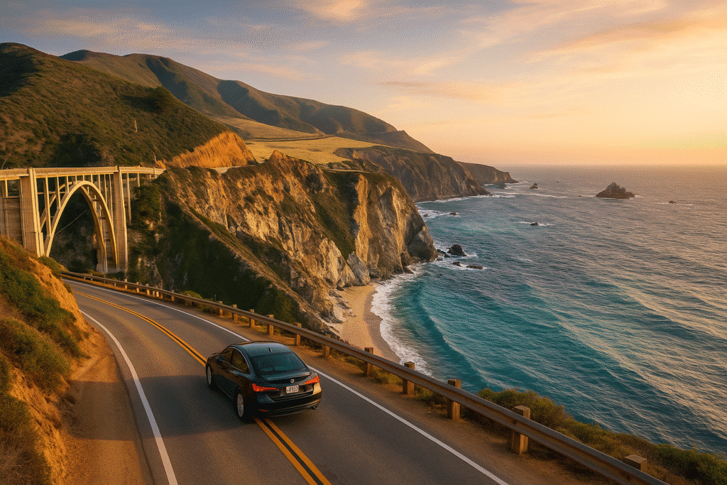
Bixby Creek Bridge
If you’ve seen one photo of Big Sur, it’s probably of Bixby Bridge. It’s 279 feet of pure “holy crap, that’s gorgeous” engineering. The best spot for photos is Castle Rock Viewpoint, just north of the bridge. But a quick warning—this place gets crowded. Like, Disneyland-at-midday crowded. So don’t be that person blocking traffic just for the perfect selfie.
Beaches Along the Big Sur Coast
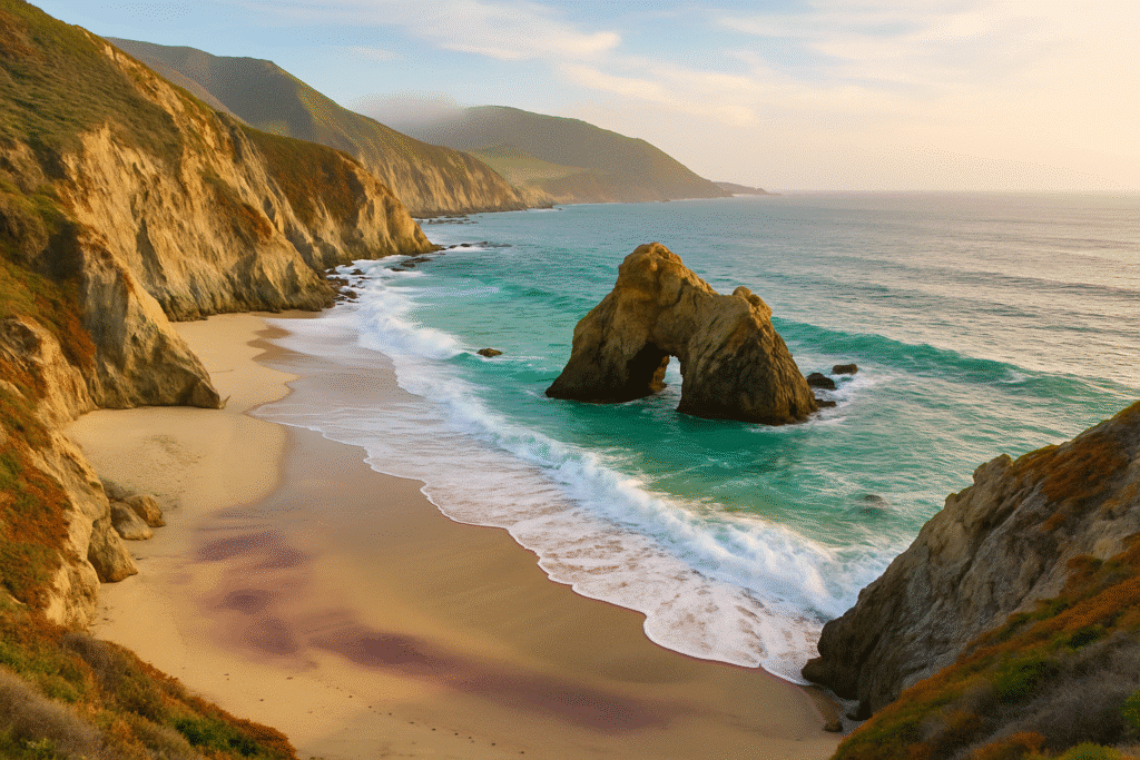
Pfeiffer Beach – Purple Sand and Keyhole Rock
Pfeiffer Beach isn’t just another pretty coastline—it’s got purple sand (from manganese deposits) and that iconic Keyhole Rock, which glows during sunset when the light cuts through its arch. It’s like nature decided to flex just a little harder here.
The road to Pfeiffer (Sycamore Canyon Road) is narrow and easy to miss, so watch the signs. And bring cash for the $12 entry fee—it’s worth every penny.
Sand Dollar Beach
If you’re looking for a more chill beach day, Sand Dollar Beach is your spot. It’s the biggest sandy beach in Big Sur, and you can actually kick off your shoes and relax without worrying about getting knocked over by waves in a tiny cove. Pro tip? Bring a picnic. It’s the kind of place you don’t want to leave quickly.
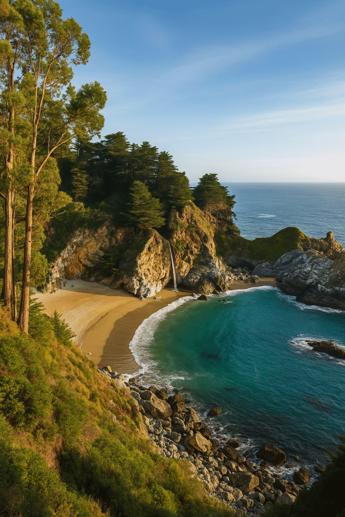
McWay Falls – The Big Sur Showstopper
This 80-foot waterfall literally drops onto the beach—yes, into the ocean. It’s one of those “did I just stumble into a postcard?” moments. McWay Falls is inside Julia Pfeiffer Burns State Park, and you can reach the viewpoint in just a couple of minutes.
But here’s the thing: there’s no beach access. Don’t try to scramble down. Just enjoy the view from above—it’s all you need.
More Iconic Stops on Your Big Sur Road Trip
Limekiln State Park – Waterfalls and Redwoods
Limekiln is one of those places that doesn’t get as much attention as McWay Falls or Bixby, but honestly, it should. Here you’ll get the perfect mix of forest and coast—think redwoods towering over creeks, small waterfalls, and trails that feel like you’re wandering through a secret hideout.
If you’re up for a short hike, the Limekiln Falls Trail is a must. It’s just over a mile round trip and leads you to a 100-foot waterfall hidden among the trees. There’s also direct beach access here, which means you can go from forest vibes to salty ocean air in minutes. Not bad for a single stop.
Andrew Molera State Park
This one’s all about wide-open spaces and rugged beauty. Andrew Molera State Park has fewer crowds, longer trails, and that raw coastal energy that Big Sur is known for. There’s a Beach Trail that takes you to a windswept stretch of sand that feels totally isolated. Bring layers—the wind here can be relentless, but the payoff is worth it.
Nepenthe – Food with a View
Let’s be real—you don’t come to Nepenthe for cheap eats. You come for the view. This iconic Big Sur restaurant is perched on a cliffside with sweeping ocean panoramas that’ll make you forget your burger costs $25.
My go-to is the Ambrosia Burger (trust me, it lives up to the name). Even if you’re not hungry, grab a coffee or glass of wine and just soak in the vibe. There’s a reason this place has been around since the 1940s—it’s basically a Big Sur institution.
Longer Big Sur Road Trips – Go Beyond the Basics
Hearst Castle – A Detour into Pure Extra
If you keep heading south past the main Big Sur stops, you’ll hit San Simeon, home of Hearst Castle. And wow—this place is something else. Imagine a mansion the size of a small village, filled with art, antiques, and pools that look like they belong in Greek mythology.
If you’ve got time, book a tour. It’s a bit of a detour, but the history (and sheer opulence) is worth the extra drive. Plus, the views from up there? Absolutely breathtaking.
Elephant Seal Vista Point
Two words: giant seals. This stop near San Simeon is home to hundreds (sometimes thousands) of elephant seals just lounging, fighting, or doing whatever it is elephant seals do. It’s free to visit and only takes a few minutes, but it’s the kind of weird and wonderful stop you’ll talk about later.
Where to Stay on a Big Sur Road Trip
Camping in Big Sur
There’s nothing like camping under the stars in Big Sur. Pfeiffer Big Sur State Park, Limekiln, and Andrew Molera all have campgrounds, but here’s the deal—you need to book early. Like, six months in advance early.
If you score a spot, you’re in for a treat. The mix of redwoods and ocean views from your campsite is something hotels just can’t replicate.
Hotels and Cabins
If roughing it isn’t your thing, Big Sur has some epic places to stay. Ventana Big Sur is pure luxury (but your wallet will cry), while smaller spots like Big Sur Lodge give you that cozy cabin vibe. Or, if you want to mix it up, you can rent a cute VRBO or Airbnb cottage near Carmel or the coast.
What to Pack for a Big Sur Road Trip
The Essentials
Packing for Big Sur is about layers and practicality. Here’s what’s always in my car:
Hiking shoes or comfy sneakers – Even short trails can get muddy.
Warm layers – Foggy mornings can be freezing, even in summer.
Rain jacket – Because coastal weather is unpredictable.
Snacks & drinks – The next store might be 40 miles away.
Offline maps – No cell service means no Google Maps.
Oh, and a good playlist. Trust me, winding down Highway 1 with the right music is an entirely different experience. I’m talking Fleetwood Mac, The Eagles, or whatever makes you feel like you’re in a California road trip movie.
Best Spots in Big Sur: Hidden Gems & Must-See Attractions From a First-Hand Perspective
Sample Big Sur Road Trip Itinerary
One-Day Plan (North to South)
Start early in Carmel-by-the-Sea. Grab coffee and pastries.
Point Lobos State Natural Reserve – Hike the Cypress Grove Trail.
Garrapata State Park – Quick walk along the Bluff Trail.
Bixby Creek Bridge – Snap that classic Big Sur shot.
Lunch at Nepenthe – Ambrosia burger + views.
Pfeiffer Beach – Explore the purple sand and Keyhole Rock.
McWay Falls – Watch the waterfall drop into the ocean.
Head back north or keep going south if you have time.
2-Day and 3-Day Big Sur Road Trip Plans
2-Day Big Sur Itinerary
If you’ve got 2 days, you can slow down and savor every mile of Highway 1. Here’s a plan that won’t feel rushed:
Day 1 (Carmel to McWay Falls):
Morning: Start with Point Lobos and a light hike (trust me, you’ll want time here).
Late Morning: Wander through Garrapata State Park and Calla Lily Valley if it’s bloom season.
Afternoon: Stop at Bixby Bridge and take your time—wait for the lighting to hit just right.
Evening: Have an early dinner at Nepenthe (grab a table outside if you can).
Overnight: Stay in a cabin at Big Sur Lodge or camp at Pfeiffer Big Sur State Park.
Day 2 (McWay Falls to San Simeon):
Morning: Head to McWay Falls for a crowd-free view of the waterfall.
Midday: Explore Limekiln State Park—do the Limekiln Falls hike.
Afternoon: Relax at Sand Dollar Beach, maybe catch the surfers in action.
Evening: If you’re still game, continue south to San Simeon and visit the Elephant Seal Vista Point.
3-Day Big Sur Itinerary
A 3-day road trip means you can dive deeper—more hikes, more secret beaches, more slow moments.
Day 1: Follow the 1-day plan but stay overnight in Big Sur.
Day 2: Hit Andrew Molera State Park, pack a picnic, and hike the Beach Trail. Spend your afternoon exploring hidden beaches (Garrapata or Pfeiffer are perfect).
Day 3: Make your way south, with stops at Sand Dollar Beach, Limekiln, and Hearst Castle. On your way back north, detour through Carmel Valley for wine tasting.
Road Trip Tips for Highway 1
The Best Way to Drive Highway 1
Always drive north to south if you can. Why? The ocean will be on your right, which means every scenic pull-off is just a quick turn without having to cross traffic. It also gives you front-row views of the coastline without other cars blocking your sightline.
The speed limit here? Don’t even worry about it. You’ll be crawling along at 25 mph half the time because (1) the curves are sharp, and (2) you’ll keep wanting to stop. And that’s the whole point.
Photography Stops You Can’t Miss
Bixby Creek Bridge – The obvious one. Sunset here is next level.
McWay Falls – Bring your zoom lens; the waterfall looks amazing from the lookout.
Point Lobos – Emerald-green coves, rocky cliffs, and wildlife.
Rocky Creek Bridge – Just north of Bixby, but way less crowded.
Calla Lily Valley (in season) – A total Instagram gem between February and March.
Food & Drink Stops Along Big Sur
Nepenthe & Cafe Kevah
Nepenthe’s big brother status comes with a price tag, but the views are worth every dollar. If you want something lighter or cheaper, head downstairs to Cafe Kevah, which has the same breathtaking views but a more casual menu (coffee, pastries, and lighter fare).
Big Sur Bakery
If you only make one coffee-and-carb stop, make it here. Their wood-fired bread and croissants are next level. It’s the perfect spot to grab road trip fuel before heading back onto Highway 1.
Big Sur Taphouse
This is where you go if you want good beer, fish tacos, and a laid-back vibe. It’s casual, it’s local, and after a day of driving and hiking, it hits the spot.
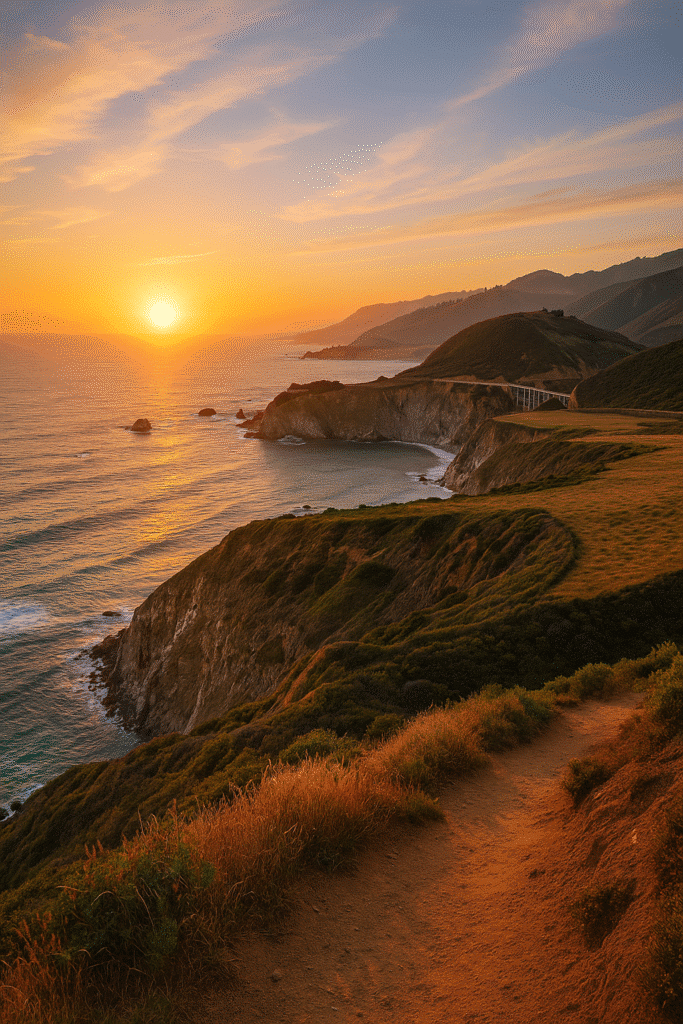
Why Big Sur Will Stick with You
Big Sur isn’t just a road trip—it’s the kind of place that gets under your skin. It’s the mix of wild coastline, fog-draped cliffs, and the feeling that you’re on the edge of the world. Every time I’ve driven this stretch, I’ve left with about 300 photos, sand in my shoes, and this weird sense of calm.
It’s not about ticking off every “must-see” stop. It’s about letting the road slow you down. Pulling over just because the sunlight looks unreal on the water. Having a burger at Nepenthe while the sun drops into the ocean. Or standing at McWay Falls in silence because, honestly, what words could do it justice?
If you’re planning a Big Sur road trip, just remember—don’t rush it. The magic is in the slow moments.
Frequently Asked Questions About Big Sur Road Trip
1. How long does it take to drive through Big Sur?
The stretch from Carmel to San Simeon is about 90 miles, but with stops, it’ll easily take 4–6 hours.
2. Can you do a Big Sur day trip from San Francisco?
Yep! It’s about a 2-hour drive to Carmel, then you can spend the rest of the day exploring Big Sur’s highlights.
3. Is Highway 1 through Big Sur open year-round?
Mostly, yes. But mudslides or wildfires can shut sections down, so always check Caltrans for updates before your trip.
4. Where should I stay if I don’t want to camp?
Big Sur Lodge, Post Ranch Inn (for luxury), or VRBO rentals in Carmel or Monterey are great picks.
5. What’s the best month to visit Big Sur?
April or October—mild weather, fewer crowds, and the scenery is next-level.