
The San Francisco to Big Sur distance is more than a measurement—it’s a gateway to one of the most beautiful road trips in the world. Whether you’re chasing ocean views, winding coastal roads, or just a relaxing escape, knowing how far Big Sur is from San Francisco helps you plan the perfect trip.
This route, which cuts through California’s iconic Pacific Coast Highway, offers unforgettable views and must-see stops like Carmel, Monterey, and Bixby Creek Bridge.
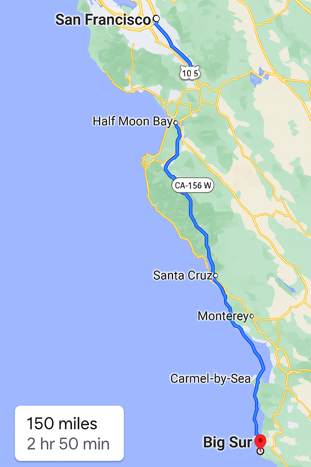
So, how far is Big Sur from San Francisco? About 150 miles. But don’t just zip through it. Every stretch of this journey offers Instagram-worthy stops, ocean breezes, and the type of beauty that’ll leave your jaw on the floor. Ready to dive into every detail of this route?
Let’s get going!
How Far is Big Sur from San Francisco? Distance and Driving Overview
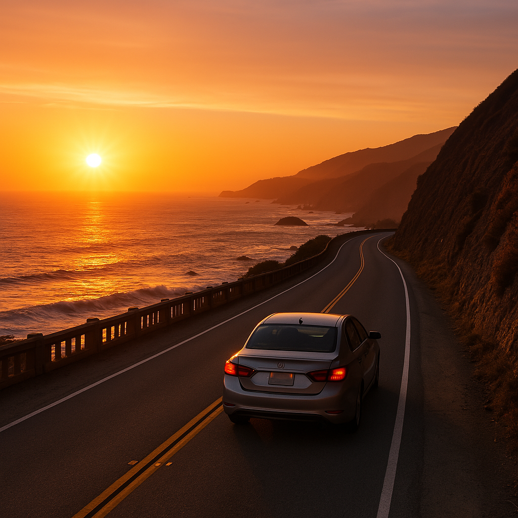
When it comes to iconic drives, the San Francisco to Big Sur distance clocks in at around 150 miles, depending on the route. That’s about a 2.5 to 3-hour drive if you’re pushing through with no stops—but trust us, you’ll want to stop. The coastal beauty demands it. The main and most scenic route is via Highway 1, also called the Pacific Coast Highway, which hugs the cliffs and showcases the best of California’s coastline.
Let’s break it down.
If you’re starting from downtown San Francisco and plugging “Big Sur” into your GPS, it’ll likely suggest a route that takes you down US-101 South, then veers off to CA-156 W, and finally joins Highway 1 South past Monterey and Carmel. This route gives you access to several key points along the way including Santa Cruz, Monterey, and Carmel-by-the-Sea.
But the big question remains: how far is Big Sur from San Francisco in travel time? Technically, you could make it in under three hours. But with traffic, coastal fog, and all the scenic detours, plan on 5 to 7 hours for a truly enriching experience. Especially if you stop at spots like Half Moon Bay, Bixby Bridge, or Pfeiffer Beach.
This drive isn’t just a means to an end—it’s a journey you’ll remember for life. The San Francisco to Big Sur distance may not be long in miles, but it’s vast in experiences. And because Big Sur doesn’t have a single city center—rather, it’s a rugged stretch of coastline—you can decide how deep you want to go.
Looking for a route visual? Check out the live Google Maps route from San Francisco to Big Sur to start mapping your drive.
Scenic Routes to Cover the San Francisco to Big Sur Distance
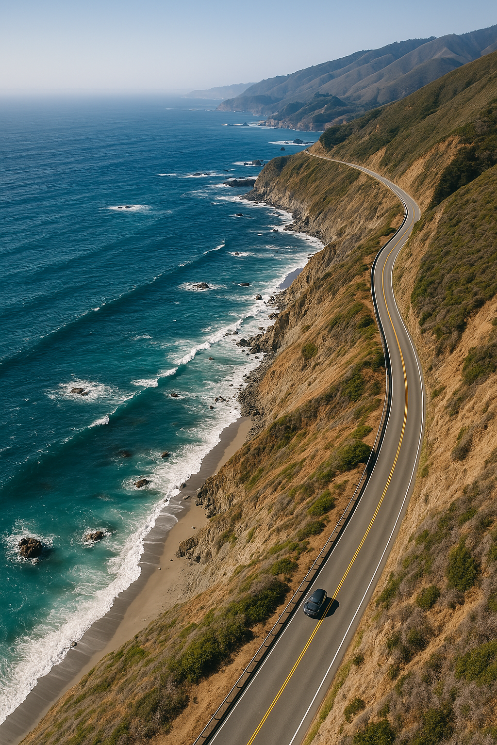
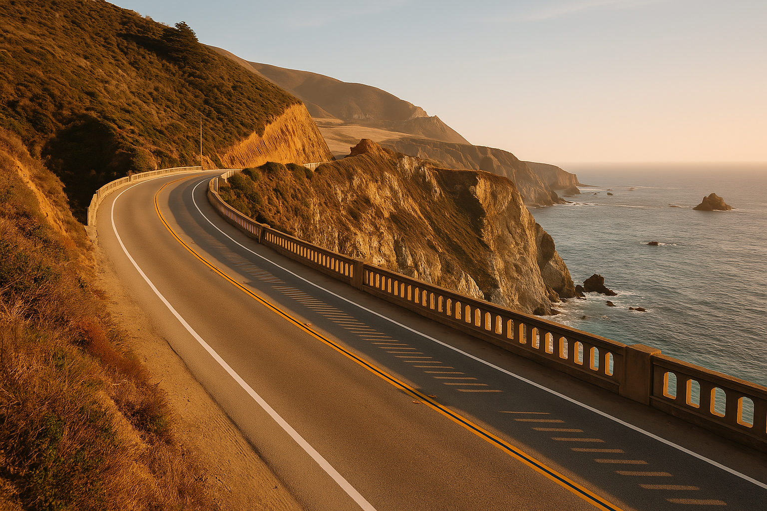
Driving the San Francisco to Big Sur distance is not just about the destination. It’s about choosing the right route to soak in every ounce of coastal beauty. While there are faster paths to get from San Francisco to Big Sur, nothing beats the raw visual feast that is the Pacific Coast Highway (Highway 1).
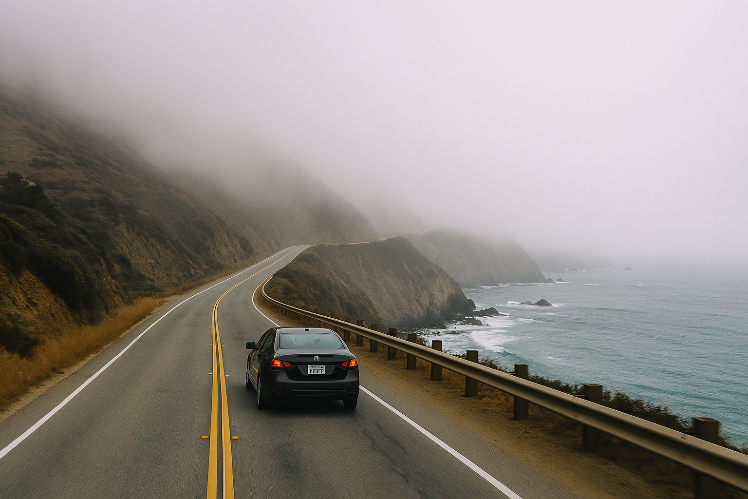
The moment you leave San Francisco, take CA-1 South through Pacifica. The ocean will peek into view, and the sound of waves crashing becomes your road trip soundtrack. Pass Half Moon Bay, where the fog rolls in mysteriously, adding a dreamlike layer to your journey.
Keep your camera ready—because every bend in the road offers something Instagram-worthy.
The route then continues toward Santa Cruz, a perfect pit stop. If you’re not in a rush to cover the full San Francisco to Big Sur distance, take a stroll along the Santa Cruz Beach Boardwalk, one of the oldest amusement parks in California. After that, you’ll drive through farmland, forests, and more rugged coast before reaching Monterey and Carmel—both essential stops.
Want a slightly faster route? You can start on US-101 South, cut across to CA-156 West, then rejoin CA-1 South near Monterey. This route is great if you’re on a time crunch, but you’ll miss a lot of ocean views.
Every mile of this route tells a story. You’ll climb hills, descend into foggy valleys, cross the epic Bixby Creek Bridge, and end up where the forest meets the sea. That’s what makes the San Francisco to Big Sur distance one of the most rewarding short road trips in the country.
Travel Time and Best Seasons for San Francisco to Big Sur Distance Drive
When is the best time to cover the San Francisco to Big Sur distance? Simple—when the weather’s great, the roads are open, and the crowds are thin. The coastal climate plays a big role in how much you enjoy this journey, so timing is everything.
Spring (March–May) is one of the best seasons to drive this route. Wildflowers bloom, skies are clearer, and there are fewer tourists clogging the roads. It’s ideal for photography, short hikes, and beach stops along the way.
Fall (September–November) is another sweet spot. You’ll avoid the summer rush, and the weather remains pleasant. Less fog, less traffic, and still plenty of daylight.
Summer (June–August) is beautiful but crowded. Hotels are expensive, parking lots are full, and Highway 1 can get jammed. However, you’ll get the best chance of sunshine and the least risk of road closures.
Winter (December–February) is dramatic, with big waves and stormy skies, but you also risk road closures due to landslides. Always check Caltrans QuickMap before hitting the road during the rainy season.
So, how long does it take to cover the San Francisco to Big Sur distance? Without stops, around 2.5 to 3 hours. With stops? Easily 6–8 hours. Start early—leaving San Francisco before 8 AM will help you avoid rush hour and give you plenty of daylight.
The San Francisco to Big Sur distance isn’t just about miles—it’s about the journey and how you experience it. Plan wisely, and your drive will be a highlight of your California adventure.
Top 10 Scenic Drives for Fall Foliage in Vermont
Car driving through coastal fog on Pacific Coast Highway near Half Moon Bay
Once you reach Carmel-by-the-Sea, you’re just at the edge of the real Big Sur wilderness. So, what’s the distance from Carmel to Big Sur? It’s a short but glorious 26-mile drive, and depending on stops and traffic, it’ll take you about 45 minutes to an hour.
This stretch between Carmel and Big Sur is where things get rugged and wild. The road narrows, cliffs get steeper, and cell service drops off completely. But trust me—this is the best part of the entire San Francisco to Big Sur distance.
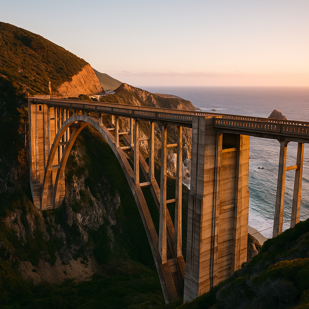
Leaving Carmel, your first highlight is the world-famous Bixby Creek Bridge—one of the most photographed spots on the entire coast. It’s a must-stop for photos. Then, it’s a winding road past Garrapata State Park, Rocky Point, and Point Sur Lighthouse.
Services are minimal past Carmel, so gas up and grab snacks before heading south. If you’re wondering how far is Big Sur from San Francisco after reaching Carmel?, you’ve got just one hour left. But this final stretch is filled with the kind of natural beauty that stops you in your tracks.
Use this part of your journey to slow down. Let the scenery sink in. Roll the windows down and breathe in the mix of salty sea and redwood earth. The distance from Carmel to Big Sur may be short, but it packs in the pure essence of coastal California.
How Far is Big Sur from Monterey on the San Francisco to Big Sur Route
The question how far is Big Sur from Monterey comes up often, especially for those doing the trip in segments. The answer: Big Sur is about 30 miles south of Monterey, which takes about 45 minutes to an hour to drive, depending on how often you stop for pictures.
This leg of the San Francisco to Big Sur distance is arguably one of the most scenic. Starting in Monterey, you’ll cruise through Pacific Grove and 17-Mile Drive, or take the direct path via Highway 1 past Carmel. From there, it’s pure Big Sur magic.
You’ll pass Point Lobos State Reserve, a hotspot for hiking, whale watching, and jaw-dropping cliff views. After that, you enter Big Sur proper, with stops like Garrapata Beach, Bixby Bridge, and Pfeiffer Big Sur State Park all along the route.
This stretch is slow-going, not because of traffic, but because you’ll want to stop a lot. The curves are sharp, the views are endless, and the vibe is pure tranquility.
Even if you’re staying in Monterey, you can still experience the soul of Big Sur in a day. Just don’t rush it. The magic lies in the drive.
Best Spots in Big Sur: Hidden Gems & Must-See Attractions From a First-Hand Perspective
Top Stops Along the San Francisco to Big Sur Distance Journey
The magic of the San Francisco to Big Sur distance lies not just in the destination—but in the unforgettable places along the way. This iconic drive is a living postcard with scenic viewpoints, charming coastal towns, and hidden natural gems. If you’re planning this road trip, build in time to explore the best stops from San Francisco to Big Sur.
Half Moon Bay
Just 30 miles from San Francisco, Half Moon Bay is an excellent place to stretch your legs. Walk along Poplar Beach, sip a latte from a cozy café, or catch a glimpse of the giant surf at Mavericks Beach. This is your first real taste of the Pacific Coast vibe.
Santa Cruz
A lively, artsy surf town around 75 miles into the San Francisco to Big Sur distance, Santa Cruz offers a little something for everyone. Ride a roller coaster at the Santa Cruz Beach Boardwalk, or hike around Wilder Ranch State Park for coastal cliff views.
Monterey
As you near the 120-mile mark, Monterey greets you with history, charm, and marine life. Tour the legendary Monterey Bay Aquarium, wander along Cannery Row, or dine at waterfront restaurants. This is also a great place to fuel up and stock snacks.
Carmel-by-the-Sea
Before diving deep into Big Sur, Carmel is a must-stop. This fairy-tale town is famous for its artsy vibe, white-sand beaches, and boutique shopping. You’ll find gas stations, grocery stores, and restaurants—so it’s your last real supply point before the remote stretch of Big Sur.
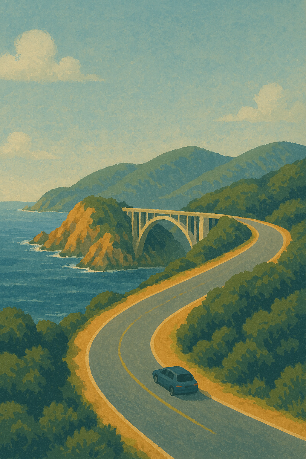
Bixby Creek Bridge
As you continue south, you’ll reach the crown jewel of the San Francisco to Big Sur distance—Bixby Bridge. Built in 1932, it’s not just a marvel of engineering but also one of the most photographed locations in California. Pull over safely and snap some shots!
Pfeiffer Beach
Tucked off the main road, this beach is known for its purple sand and Keyhole Arch Rock, especially stunning at sunset. Bring $12 cash for parking and prepare for a bumpy ride down the narrow Sycamore Canyon Road—but the view is totally worth it.
McWay Falls
Your final major stop, McWay Falls, is the ultimate reward for making it the full San Francisco to Big Sur distance. This waterfall drops directly onto the beach and into the ocean. It’s accessible via a short hike and should not be missed.
Each of these stops enhances your road trip. Don’t rush—this isn’t a commute. It’s a journey made for memory-making.
Essential Driving Tips for Covering the San Francisco to Big Sur Distance
While the San Francisco to Big Sur distance offers spectacular views, it’s also a route that demands your full attention. The winding cliffs, unpredictable weather, and long stretches without services make safe and smart driving essential.
1. Fill Up Your Gas Tank Before Carmel
After Carmel, gas stations are rare and expensive. Fill your tank in Monterey or Carmel-by-the-Sea before heading south.
2. Download Offline Maps
Cell service is spotty once you’re past Carmel. Download Google Maps offline or use an app like Maps.me to ensure you stay on course.
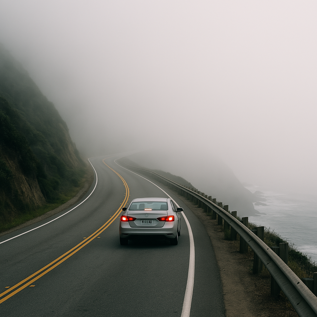
3. Watch for Weather
Fog and rain can roll in fast, especially in early morning or late evening. If visibility drops, turn on your headlights and slow down. Check road conditions via Caltrans QuickMap before departure.
4. Mind the Curves
Highway 1 includes sharp turns and narrow lanes. Don’t speed, especially around blind curves. If cars pile up behind you, use a turnout to let them pass.
5. Plan for Daylight Driving
Try not to drive this route after dark. It lacks lighting, and the twists and cliffs become much harder to navigate at night. Start your drive early—ideally by 8 AM.
6. Carry Snacks and Water
There are long stretches with no stores or restaurants. Pack light snacks, water, and a picnic lunch. If you’re stopping at a beach, a blanket and cooler can turn any overlook into a lunch with a view.
7. Emergency Kit is a Must
Pack a basic roadside emergency kit—jumper cables, flashlight, spare tire, and a first-aid kit. Most of Big Sur has no cell service, so be prepared.
8. Respect Wildlife and Nature
Watch for animals on the road and do not feed or approach wildlife. Stay on marked trails and pack out what you bring in.
Driving the San Francisco to Big Sur distance isn’t difficult, but it’s not your average freeway cruise. Prepare well, stay alert, and treat the drive like part of the adventure—it is.
Top 20 Scenic Byways in the USA That Will Blow Your Mind in 2025 (With Maps, Tips & Things to Do)
9. Where to Stay While Driving the San Francisco to Big Sur Distance
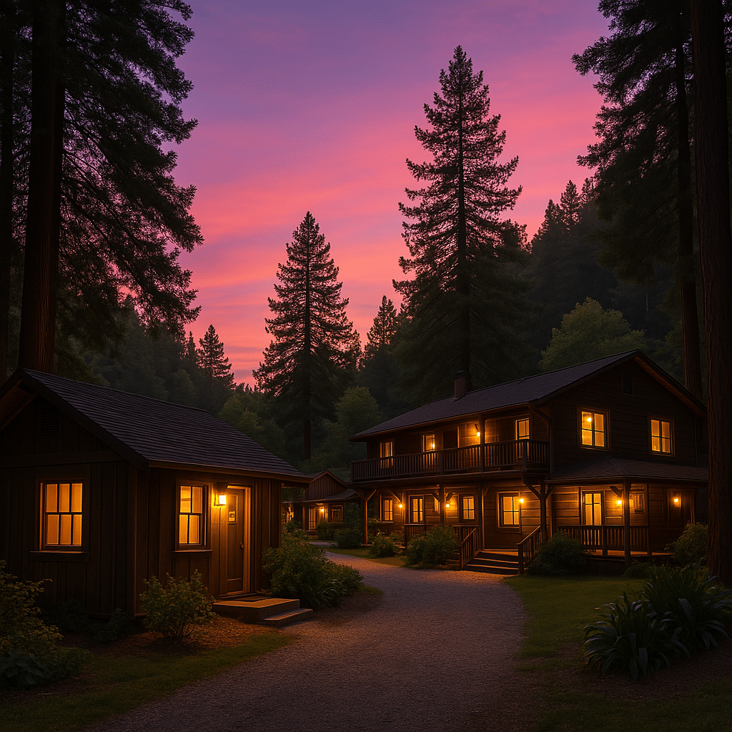
Covering the San Francisco to Big Sur distance in one day is possible, but staying overnight unlocks the real magic. As daylight fades and the stars take over, the peacefulness of Big Sur offers a unique kind of escape. Whether you’re glamping or splurging on luxury, the lodging options here range from rugged to refined.
Camping in Big Sur
For nature lovers, camping under redwoods is a dream come true. You’ll need to book months in advance—especially in summer—but it’s worth it.
-
Pfeiffer Big Sur State Park Campground – Nestled among giant redwoods and close to Big Sur River trails.
-
Limekiln State Park – Beach access and waterfall hikes within walking distance.
-
Ventana Campground – Offers both tent camping and luxurious glamping tents.
Rustic Cabins and Budget Inns
If tents aren’t your style, try one of Big Sur’s cozy inns or rustic cabins.
-
Big Sur River Inn – Laid-back rooms with riverside dining.
-
Ripplewood Resort – Cabins with kitchens, ideal for longer stays.
-
Deetjen’s Big Sur Inn – Old-world charm and legendary breakfasts.
Luxury Stays
Celebrating something special or just want to go all out? Big Sur has two show-stopping resorts:
-
Post Ranch Inn – Cliff-top suites with infinity tubs and ocean views.
-
Alila Ventana Big Sur – Adult-only resort offering spa treatments, fine dining, and forest luxury.
Staying in Carmel or Monterey
If Big Sur lodging is full or out of budget, base yourself in Carmel or Monterey. You’re only 45–60 minutes from Big Sur and can day-trip into the region with ease.
Whether you want a campfire under the stars or a glass of wine in a cliffside tub, there’s an option to match your travel style.
10. Where to Eat Along the San Francisco to Big Sur distance Road Trip
You won’t find fast food chains along the San Francisco to Big Sur distance, and that’s a good thing. Dining here is all about savoring the moment—whether it’s a burger with a view or a pastry with a side of redwoods.
In Monterey and Carmel
Before you reach Big Sur’s remote stretch, fuel up in Monterey or Carmel.
-
Café Lumiere – Great coffee and breakfast in Monterey.
-
The Cheese Shop (Carmel) – Load up on artisan snacks for the drive.
-
La Bicyclette (Carmel) – Cozy French-Italian fusion spot perfect for lunch.
Big Sur Dining Gems
Here are must-visit restaurants once you’re deep into Big Sur:
-
Nepenthe – Perhaps the most famous Big Sur eatery. Dine on the deck and watch the ocean roll in.
-
Big Sur Bakery – Coffee, wood-fired pizza, and desserts that’ll make you wish you lived nearby.
-
Sierra Mar at Post Ranch Inn – Gourmet tasting menus in a glass-walled dining room overlooking the Pacific.
-
Deetjen’s Restaurant – Old-world vibes and hearty breakfasts like eggs benedict and pancakes.
-
Fernwood Tavern – Live music, pub food, and a local crowd.
Groceries and Snacks
-
Big Sur Deli & Tap House – Quick sandwiches and drinks.
-
Ripplewood Resort Store – Essentials and snacks if you’re staying nearby.
Eating your way down the San Francisco to Big Sur distance is a journey in itself. Just remember—many places close early, so plan meals ahead.
11. What to Pack for Your San Francisco to Big Sur Distance Adventure
Planning your packing list for the San Francisco to Big Sur distance road trip? Great! Because the drive might be short in miles, but it’s long in weather shifts, photo stops, and potential surprises. You’ll want to be prepared for just about everything—from coastal fog to forest hikes.
Clothing Essentials
-
Layered Clothing: It can be 80°F in Monterey and drop to 50°F near Big Sur. Bring layers like a hoodie, windbreaker, or fleece.
-
Comfortable Walking Shoes: For scenic trails, redwood walks, or climbing down to beaches.
-
Sunglasses & Hat: The sun can be blinding on cliff-top drives.
-
Rain Jacket: Especially from November to March—coastal rain can sneak up on you.
Road Trip Essentials
-
Reusable Water Bottle: Fewer stops, more hydration.
-
Cooler with Snacks: Perfect for picnic stops and beach hangs.
-
Phone Mount & Car Charger: Keep your phone secure for GPS and photos.
-
Offline Maps or Printed Directions: Signal disappears quickly south of Carmel.
For Outdoor Adventures
-
Daypack: Small backpack for hikes or beach days.
-
Towel or Blanket: For beach lounging or impromptu picnics.
-
Binoculars: Spot sea otters, whales, and birds at vista points.
-
Camera or GoPro: Trust us—you’ll want to capture this drive.
Safety & Navigation
-
First Aid Kit: Include band-aids, painkillers, bug spray, and allergy meds.
-
Spare Tire & Tools: Highway 1 is remote—be self-sufficient.
-
Flashlight or Headlamp: In case you stop or camp overnight.
Cash & Cards
-
Some stores and campgrounds only accept cash. Have at least $40–$60 on hand just in case.
Covering the San Francisco to Big Sur distance means entering zones with no stores, limited Wi-Fi, and few conveniences. Packing smart ensures you spend less time stressing and more time soaking in those once-in-a-lifetime views.
Best Fall Foliage Routes in New England: Discover the Ultimate Leaf-Peeping Drives
Natural Attractions You’ll See Driving from San Francisco to Big Sur distance
Let’s be real: the San Francisco to Big Sur distance is worth every mile simply because of the natural beauty you’ll encounter. This route is a showcase of California’s diverse ecosystems—crashing waves, old-growth forests, secluded beaches, and dramatic cliffs that drop into the sea.
Pfeiffer Big Sur State Park
Nicknamed the “mini Yosemite” of the coast, this park has river trails, redwoods, and easy hikes. Valley View Trail gives a stunning overlook of the Big Sur River Valley. Don’t miss a walk along the River Path Trail, ideal for a relaxing stroll beneath towering trees.
McWay Falls at Julia Pfeiffer Burns State Park
A jewel of the Big Sur coastline. This 80-foot waterfall spills onto a beach that looks like something out of a travel magazine. It’s just off Highway 1 with a short trail to a viewing platform. One of the most famous stops on the entire San Francisco to Big Sur distance.
Bixby Creek Bridge
If you only stop at one place, make it this one. Bixby Bridge is one of the most iconic photo spots in California and is located just 15 miles south of Carmel. Come at sunrise or sunset for the best lighting.
Point Lobos State Natural Reserve
Located just south of Carmel, this place is a dream for hikers and wildlife lovers. Watch sea lions, otters, and migrating whales from easy trails with breathtaking ocean views.
Garrapata State Park
This lesser-known stop includes both coastal cliffs and inland canyons. Soberanes Point Trail is short but offers big views of waves smashing into rock walls.
Partington Cove
A hidden gem located near Julia Pfeiffer Burns. Hike through a tunnel to a secluded cove where rugged cliffs and turquoise water await.
This entire San Francisco to Big Sur distance could be rebranded as the Natural Wonders Tour. The coastline doesn’t just connect two points on a map—it invites you to stop, stare, and feel totally alive.
Outdoor Adventures to Enjoy Along the San Francisco to Big Sur Drive
One of the best things about the San Francisco to Big Sur distance? It’s not just a pretty drive—you can actually get out and do stuff. From hikes to kayaking to stargazing, this region is packed with outdoor adventures that let you interact with nature rather than just look at it.
Hiking
-
Ewoldsen Trail (Julia Pfeiffer Burns State Park): Forests, ridges, and ocean views all in one moderately challenging hike.
-
Buzzard’s Roost (Pfeiffer Big Sur State Park): A loop through redwoods leading to a panoramic lookout.
-
Soberanes Canyon Trail (Garrapata State Park): Start in a forest, end with ocean views—classic Big Sur.
Beach Time
-
Pfeiffer Beach: Known for its purple sand and epic sunset shots through the rock arch.
-
Sand Dollar Beach: Big Sur’s largest sandy beach, great for surfing or sunbathing.
-
Garrapata Beach: Quiet and dramatic, ideal for long walks and watching the waves.
Water Activities
-
Kayaking in Monterey Bay: Paddle with sea lions and otters.
-
Tidepooling: Check out the marine life at Point Lobos or Natural Bridges.
Wildlife Watching
You don’t even have to leave your car to spot sea otters, elephant seals, or whales migrating just off the coast. Bring binoculars and keep an eye on the water.
Stargazing
At night, especially near Big Sur Campground or Limekiln, you’ll see a sky full of stars. No light pollution, just nature at its finest.
No matter your pace or style, the San Francisco to Big Sur distance is an open invitation to reconnect with the great outdoors.
Why the San Francisco to Big Sur Distance is Worth the Trip
So, is driving the San Francisco to Big Sur distance really worth it?
Yes. A hundred times yes.
This isn’t just another road trip. It’s one of the most iconic drives in the U.S., offering a mix of nature, solitude, charm, and wow-factor views that few places can match. In just 150 miles, you’ll transition from big-city buzz to coastal bliss.
You’ll start in San Francisco’s urban sprawl, pass through beach towns like Half Moon Bay and Santa Cruz, wind past the cultural richness of Monterey and Carmel, and finally land in the raw, untamed beauty of Big Sur.
Even better? You can tailor the trip to your schedule. Go for a day. Stay a weekend. Or take a whole week and soak in every trail, sunset, and sea breeze along the way.
The San Francisco to Big Sur distance is short enough to be doable but long enough to transport you to another world. It’s an escape, a journey, and a reset button all in one.
Google Map Route Overview of the San Francisco to Big Sur Drive
Here’s your go-to route overview for planning the drive:
📍 Start Point: San Francisco, CA
📍 End Point: Big Sur, CA
🛣️ Route: US-101 S → CA-156 W → CA-1 S (Pacific Coast Highway)
📏 Distance: Approx. 150 miles
🕒 Estimated Drive Time: 2.5 to 3.5 hours (non-stop)
👉 Google Maps – San Francisco to Big Sur Drive
Use this link to find scenic pull-offs, rest areas, and fuel stations along the way. Pro tip: save the map offline before you go. You’ll lose signal once you pass Carmel.
Discover Secluded Coastal Gems Along Hidden Beaches in Gulf Shores
Final Thoughts on Driving the San Francisco to Big Sur Distance
Whether you’re a California local or a visiting traveler, covering the San Francisco to Big Sur distance is a rite of passage. It’s the kind of journey that delivers something new each time—new sights, new stops, new memories.
From the city’s skyline to redwood forests, beach walks, and cliffside sunsets, this drive gives you a front-row seat to nature’s masterpiece. And the best part? It’s all within a few hours of one of the country’s biggest cities.
So pack your bag, cue up your road trip playlist, and hit the Pacific Coast Highway. Big Sur is waiting.
FAQs
1. Is one day enough to drive the San Francisco to Big Sur distance and back?
Yes, but it’ll be rushed. If possible, stay overnight to explore at a relaxed pace.
2. Can I take a bus or train for the San Francisco to Big Sur distance?
Not directly. You can reach Monterey by public transport, but you’ll need a car to access Big Sur.
3. Is the Pacific Coast Highway safe for first-time drivers?
Yes, but drive slow, stay alert, and pull over for faster drivers. Fog and curves can be tricky.
4. What are must-see stops between San Francisco and Big Sur?
Bixby Bridge, McWay Falls, Carmel-by-the-Sea, and Pfeiffer Beach are essentials.
5. Are there any tolls or permits needed to drive from San Francisco to Big Sur?
No tolls, but some state parks charge a $10–$12 parking fee.